German Map
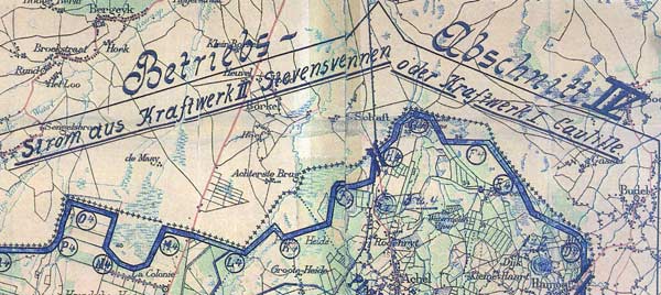
German military map showing the Electric Fence and which powerstations the current came from
Mapping the Electric Fence and Its Power Supply
This German military map shows the Electric Fence on the Belgian-Dutch border and indicates where the current came from. The image helps explain the system not only as a physical barrier, but as an engineered network of surveillance, power stations and occupied-border control.
- Click on the picture to go back to the summary page or click here to go to the frontpage of The Heritage of the Great War.